
South Okanagan Geography
The Oliver Osoyoos Winery Association is a non-profit organization with a goal to develop the wine industry in Oliver and Osoyoos through education and promotion. Originally known as the South Okanagan Winery Association and founded in 2006, the Oliver Osoyoos Winery Association (OOWA) redefined its brand image in 2011 to better reflect its geographical boundaries.
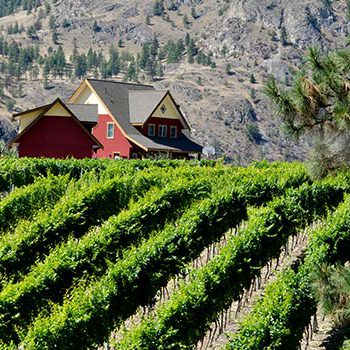
To the north, basalt-faced McIntyre Bluff acts as a buffer and aids in creating a microclimate unique to the South Okanagan. It denotes the end of one geographic zone and beginning of another – McIntyre Bluff is the northernmost point of the Great Basin Desert. As you pass through, a subtle shift in landscape is noticeable: the darker antelope brush found in the south is slowly replaced by more grey/green sagebrush, and barren grasslands experience an increase of vegetation and shrubs.
To the south, Osoyoos Lake moderates temperatures and provides a water source for wildlife. Fed by the Okanagan River, Osoyoos Lake extends into Washington State and connects, eventually, to the Columbia River. Ponderosa pine and Douglas fir are original to the area and cling to the sides of Anarchist Mountain, bordering the east. In the west, a slow climb up the Okanagan Range keeps the area in a rain shadow and helps maintain the region’s desert-like climate.
The area was sculpted eons ago by glacial movement, and its soil is rich with pockets of clay, limestone, and granite – ideal for growing grapes with which to express this distinctive terroir.
